GET ON THE RIGHT WAY

About ARTIPLE
Artiple works in almost all verticals of Laser scanning
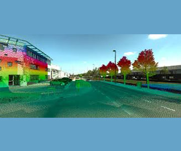
Lidar surveying and engineering. Begin by scanning the project site using a 3D laser scanner to capture real world information of buildings, infrastructure and industrial facilities into the digital world.
Our solutions are effective and low cost
We provide deliverables based on international standards of engineering. we are proving Compressive Latest 3D laser scanning and Lidar technology for Reality Capture to error free as Built Creation from Point Cloud.
10+
ARTIPLE
Years of of experience — in the field of 3D Laser Scanning Services and Lidar Technologies
and providing the latest 3D data capture methods and techniques to offer you productive and error-free solutions with higher accuracy. Our domain expertise includes BIM, Revit, Reverse Engineering (Point cloud), 3D CAD model and 2D drawing generations, Lidar data processing,Mobile mapping, GIS mapping.
Artiple Services
Lidar data processing
Artiple Services
BIM and 3D Modelling
Artiple Services
GIS Mapping
Why Artiple
Our Experience
We have collective experience of more than 10 years in the domain. The knowledge and skilled pick-up along the way help us in utilising in the project helps in assisting our client better.
Adopting new technology and software:
We always keep up to date with latest trend and technology. We always encourage and practice indulging with new things. Our R&D team constantly thrive for challenges which allows to come up with various innovative solutions and ways to keep our service offerings at its peak.
On time & Customer focused:
We have a best QC and QA management system. We are proud of our quality standard, on time and constantly keep updating to stay on top notch. This, we strongly believe, set us apart from others.
Security for client data and file:
We believe that in today’s world DATA IS THE NEW OIL. Hence, we have strict data management system led by our IT team. We maintain strict protocol on data confidentiality, data back up with constantly updated in regular basis.

Our Services
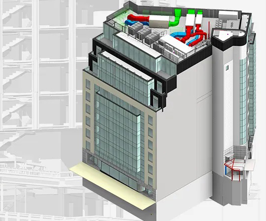
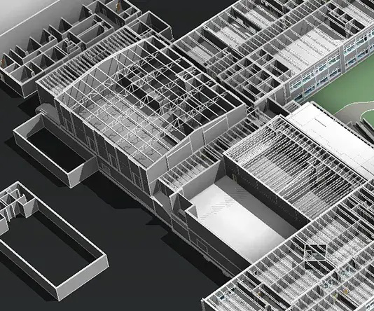
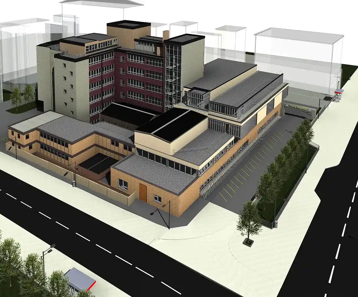
BIM and 3D Modelling
(point cloud) We developed a method which delivers accurate and fast survey information in a BIM-ready model. Our team is ready to work within the design and construction industry to create a BIM models (Revit), CAD 3D and 2D with huge database of information by using point cloud data.
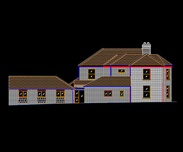
2D to 3D modelling
Our Team have experienced in transforming the CAD drawing, PDFs into 3D model with rich details. Based on the Level of detail/development (LOD) specification agreed with the client the Building information modelling (BIM) delivered by adding information to each object
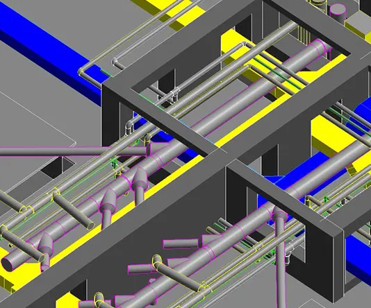
Lidar data processing
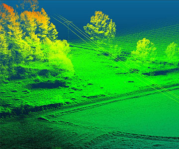
LiDAR(Light Detection And Ranging) is an optical remote sensing technology that can measure the distance to, or other properties of a target by illuminating the target with light, often using pulses from a laser, with very high accuracy and detail.
Mobile Mapping
Mobile mapping is the means of collecting geospatial data using mapping sensors that are mounted on a mobile platform. . Cameras, Mobile scanners, hand scanners along with navigation and positioning sensors, e.g., the Global Positioning System (GPS).
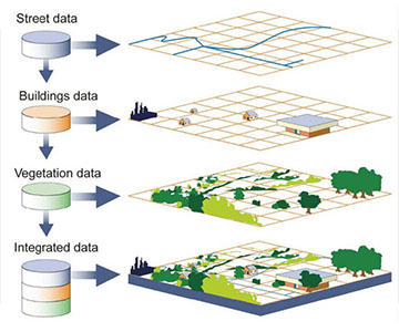
GIS Mapping
Many conversion projects require the translation of existing digital data obtained from legacy data systems. Data migration projects include source data in AutoCAD, Micro Station, dBase, Microsoft Access, etc.
CAD to BIM Services
We can transform 2D CAD Drawings into high precision and information rich 3D BIM Models. These models make it possible to virtually visualize a building design and depict accurate building function and properties. We can maintain a single model right from conceptual design through development, construction and maintenance. Our track record of working on diverse buildings and projects. We are one of the most sought-after CAD to BIM Service Providers owing to our penchant to deliver high precision 3d Models in affordable prices. We work on Architectural, Structural and MEP Models up to LOD 500 making us one of the most sought after BIM Modeling Companies.
BIM Coordination Services
Along side interference check reports and clash detection, we also provide BIM Coordination Modelling services to global clients. We provide 3D Coordination services using Revit, Navisworks etc. to clients with a goal of reducing construction errors and minimize costing during on-site construction. Our team of BIM Coordinators ensure that we work with optimum tolerance window, enabling efficient coordination of the interdisciplinary models. We facilitate online coordination meetings using Teams, Zoom with Engineers, Stake holder, Architects and contractor to ensure seamless service experience. Our experience and track record of working on complex 3d Coordination projects make us one of the most sorted BIM Coordination Services Providers.
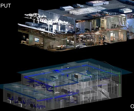
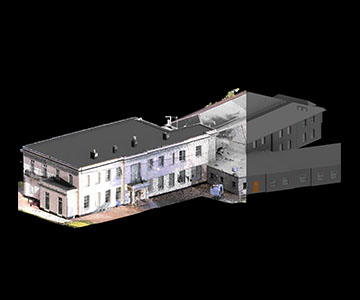
Scan to BIM Services
We work on highly detailed and accurate point cloud to BIM Modelling services using Revit, ArchiCAD etc. We convert point cloud files or laser scans to precise 3D BIM Models that can be used to represent 3d geometry of an existing structure. This model can later be used for presentation, analysis and renovation of an existing building structure. We have worked on multiple building types like Historical buildings, Commercial and Residential Buildings, Bridge and Railways, PowerStation’s, Cell phone towers etc. Our BIM Architects and Engineers are proficient in converting scans of different formats into precise 3D Revit or ArchiCAD models. Our point cloud to BIM Modelling services is widely used by Survey companies globally.
Clash Detection Services
We have a proven track record of being one of the most preferred clash detection service provider in USA. Our global client base for these services includes General Contractors, consultants and Construction companies. We work on multiple building types with diverse scale and size. Our team of BIM Coordination experts and Engineers ensure that the interference checks are performed at multiple stages of Modelling, which leads to accurate and coordinated BIM Models. We use Revit, Navisworks etc. for clash detection between Architectural, Structural and MEP discipline.
As Built documentation
We are experts in As Built documentation services in 2D and 3D both. As Built documentation are a clear depiction of how the building is constructed. These drawings are then updated based on any construction modifications performed onsite but not present in the final construction set. As built model or drawings, are usually utilized for measuring the accuracy of the construction drawings vs the as built state of building. These drawings are functionally used during facility management and also can be maintained for future renovations or maintenance. We work on updating As built Drawings in Revit based on mark ups and updations providing by our client.
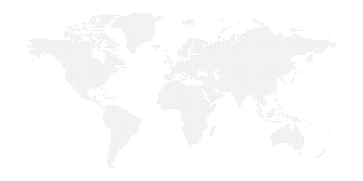
Globally renowed & tested
Artiple Working Everywhere
TRY OUR SERVICES
Get Free Quote

+91 80509 99090
sales@artiple.in
412H 4th cross,Vijaynagar Bangalore-560040
We have collective experience of more than 10 years in the domain